Eagle Roost / Valley of the Eagle Airparks
Aguila Area
Local History and Explorations


Culling's Well

Residents of Valley of the Eagle and Eagle Roost go out to play over or on the desert surrounding Aguila and often discover pieces of history.

1. The story of Culling's Well.

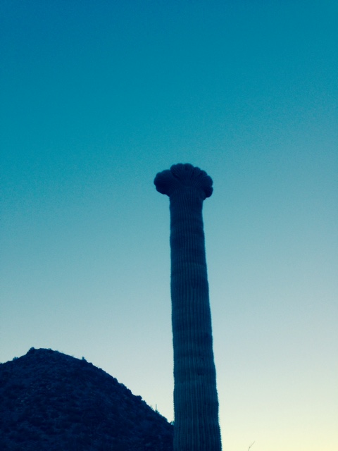
Crested Saguaro

Link to a full article about this famous site.

Explore the ruins of Cullings Well today.

Follow Up to the article above:

This story was originated by Bob Sailor who has a lot of fun flying his Rans Coyote exploring the desert around Aguila.
After seeing a strange outline in the desert floor the Valley of the Eagle gang went to find out what it was on the ground.

Here are the results: (click the pictures for a larger rendition)

In the desert a few miles West of Gladen, AZ on the South side of Highway 60 and about 5 miles East and a little South of the Culling's well site is another well that is about 246 feet deep it was hand dug ,very old and dry. It is cribbed down about eight feet. It has a wooden cover that is seriously deteriorated. The finders believe that this is the first well that Culling or Cullen dug. It is on BLM land. There are no roads to it so it should remain undisturbed. by Dennis Huwe

Comments:

Pretty amazing that this "hole" was dug by hand.

The old deteriorated cover.
(Unbelieveable how Bob spotted this from the air)
The hole ! and what a hole it is !
Take a wild trip down the well... Don't get dizzy At the bottom. Pretty good for a cell phone.
Here's Bob Sailor taking pictures and making the videos.
November 10, 2018 Update - by Gary Eisert
 
There are no roads but we made it to the well. The rain did a lot of damage in the desert this last summer, most avenues were blocked by deep washouts you couldn't hope to get across, even with an ATV. We hiked some distance to get to it.
As you can see the cover has changed a lot due to the heavy rains. Not much left of it.
If you throw a rock down the hole you can count to 5-6 before you hear a deep thump sound when it hits bottom.
Looking south from the well site.

Crested Saguaros
Bob Sailor has found a lot of these wonderous works of nature around the area.

This one is north west of Aguila.

Crested Saguaro

Crested 4 is at Indian Springs.

Coordinate are approx.
33 deg 52' 15.47"
113 deg 11' 44.49"

On the way out there is a squarish rock on the left side of the trail at a curve. The crested is straight ahead.

Crested 8 is Behind Eagle Eye Mtn.

Coordinates are approx.
33deg 51Mn 08.10Sec
113deg 02mn 15.44sec

Go around the South side and come back North between the two hills there is a little turn around and the cactus is straight East across a little wash. Someone has put some white paint on the lower part.

Crested 18 is at Indian Springs.

Coordinates are Approx
33 deg 52' 12.38"
113 deg 11' 59.26"

If you walk past the stone tank to the stone corral and look Northwest to the left of the stone ​buildings across the wash you should see it. I can also be seen from the stone buildings.


Big Saguaros in our area.

This is the tallest Cactus that we have found in the area. We estimate close to 50 feet. It has about 30 "arms" on it. It is North of Bullard pass before you get to the Alamo road on the West side of the road.​by Dennis Huwe

Next fall we intend to scientifically measure this one.

So OK, Who has the biggest ???

Update Fall 2019

Sad, that after hundreds of years this mighty Saguaro finally gave up it's fight against nature. This cactus was probably alive when the Declaration of Independence was signed.

Mark Sheridan is in first slide to give you an idea of the overall size.